")

Climbing Mount Epomeo


The island of Ischia thanks to its geo-morphological and climatic peculiarities represents a unique environment in the Mediterranean Sea, a chest full of treasures, a laboratory in which to live and understand the meaning of the concept of biodiversity. From a geological point of view it is a complex of several raised and inclined plots, separated by fractures and faults that were used often as way out of the magma of the local catchment area, thus giving rise to a series of volcanic structures.
One particularly important event in the island's geological history is represented by the eruption of the green tuff. About 55,000 years ago, formed a giant magma chamber beneath the present-day island of Ischia. Through cracks and crevices in the earth's crust, the magma was thrown into the atmosphere and the magma chamber was emptied. The cover of the magma chamber collapsed and the basin that was created in the earth's crust, called "Caldera", is where today lies the island of Ischia. Since ca. 55,000 years ago, the sea surface was ca. 150-200 m lower than today, this "Conca-Caldera" was dry land. After the increase of the sea level, the island was submerged for several years. This has meant that the original rock, as a result of chemical transformations, has turned into green tuff.
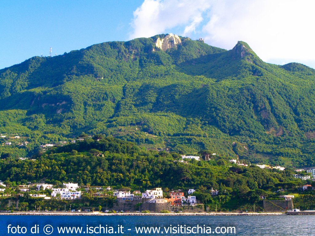
New magma flowed in the old magma chamber beneath the present-day island of Ischia, the cover of the magma chamber began to rise from the sea and bring out the island. This increase has given rise to Mount Epomeo now rises to a maximum height of about 789 m above sea level. The fact that the island emerged from the sea, and from mineralogical characteristics, is also confirmed by the presence of marine clays overlaying the green tuff and fossil molluscs and foraminifera. In the area of the forest of Falanga and Frassitelli is particularly evident on the fault plane and lifting which then gave rise to the mountain (horst Volcano - tectonic). The volcanic activity is currently in a quiescent phase, and is characterized by the development of very intense hydrothermal springs and fumaroles.
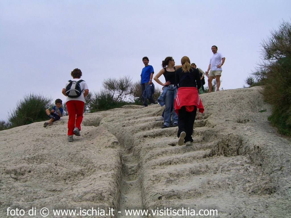
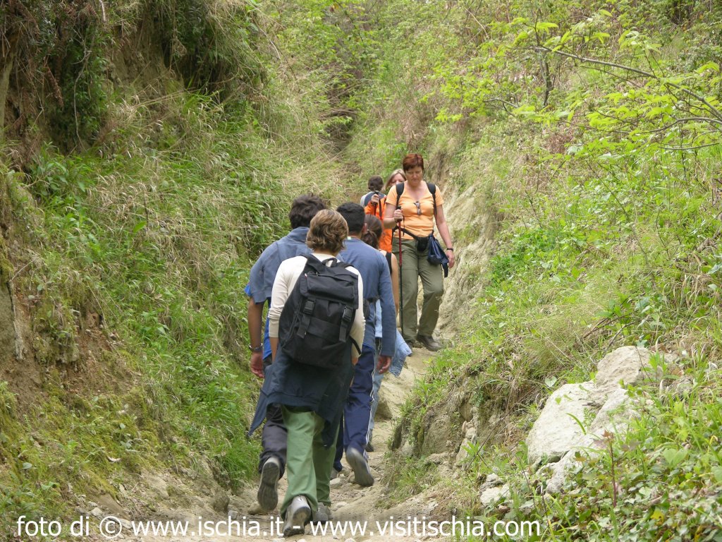
The ascent to Mount Epomeo is definitely an experience not to be missed for those who visit, live or love the island of Ischia. There are many possible paths to reach it. The proposed route, crossing the island from one side to another, will experience some of the geological history - environmental and anthropological aspect of the island.
It starts from the riding of horses in Fiaiano (village of Barano of Ischia) and you enter at once into a chestnut. During spring (best time to experience this, because of the many blooms) once the view is captured by the light color of the flowers of chestnut, from Monte Toppo (427 meters above sea level) to rise, seem typical golden brushstrokes in the deep green sea, intense characteristic of buy essay and a large island floristic richness.
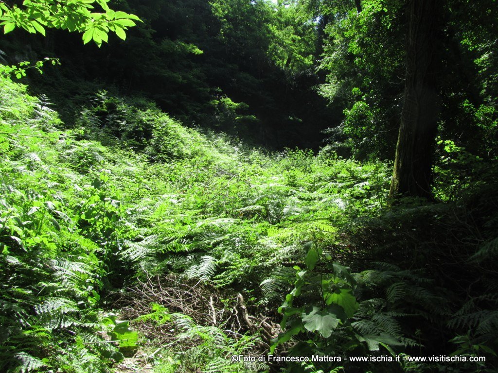
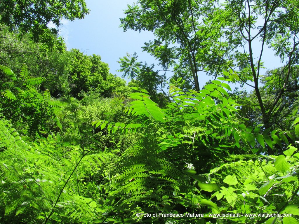
This slope indicates a large island and rich flora. Inside the path that goes back to the valley of Buceto, where is the homonym source, the first stretch is accompanied by the remains of the old aqueduct that captured water from the spring and brought to the village of Celsa (current Ischia Ponte). Given the high exposure of this first section, the predominant vegetation is typical of the Mediterranean Sea, where there are the essences of fragrant myrtle enriched by the aromas of wild mint and thyme. After a while, as if by magic, the landscape changes: the particular location and geomorphological configuration of the valley, and the abundance of water (just the source of Buceto), the presence of tall poplars and ailaianti epifitati by creeping and streamers ivy that look like vines and low ferns and tall burdock leaves at least one meter wide, the chirping of birds, making this stretch like a tropical forest.
There has been immersed in this world, for a moment losing the sense of space and time. But Ischia is also this: thanks to its geo - bio - morphic - climatic variability, in a limited space where grow many different environments, from those typical of the Mediterranean, those ones of high mountains to the tropical ones.
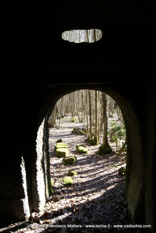
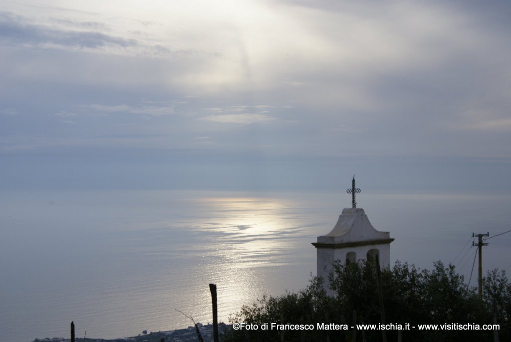
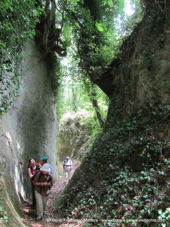
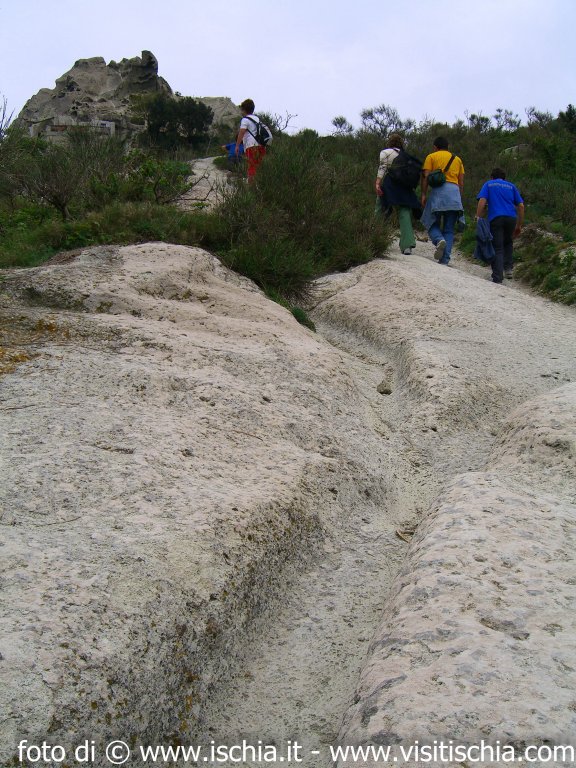
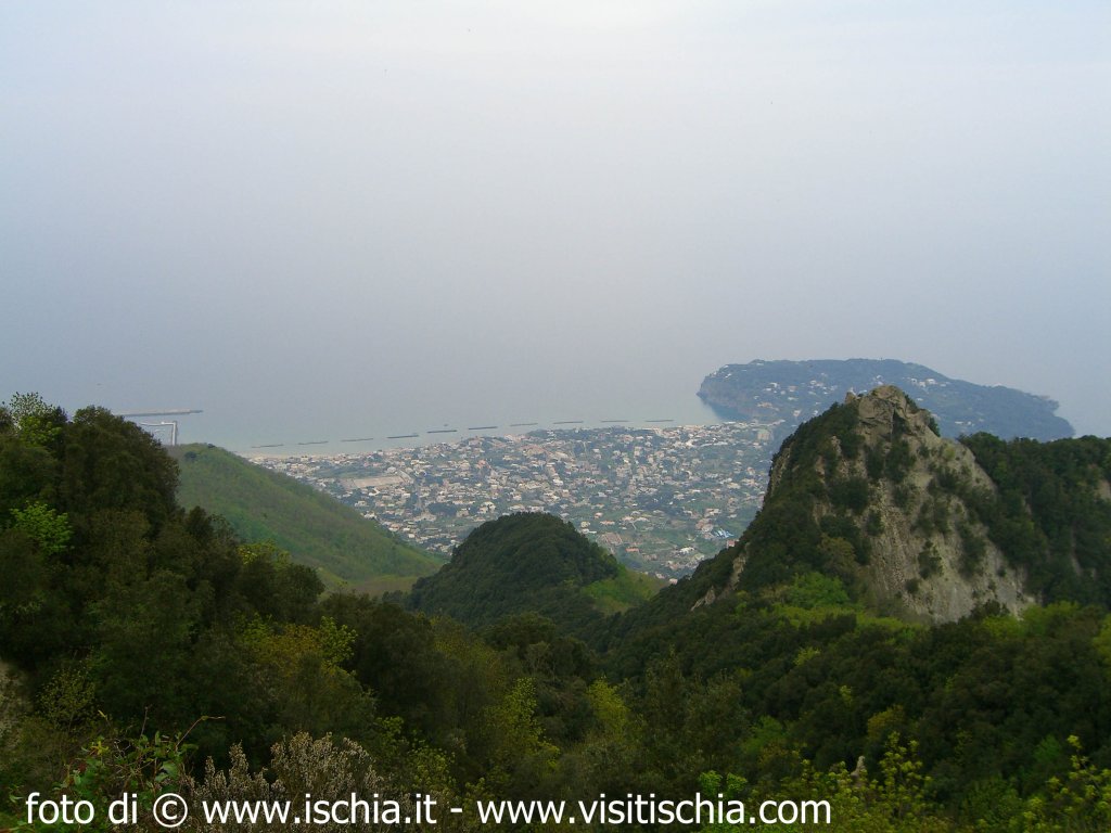
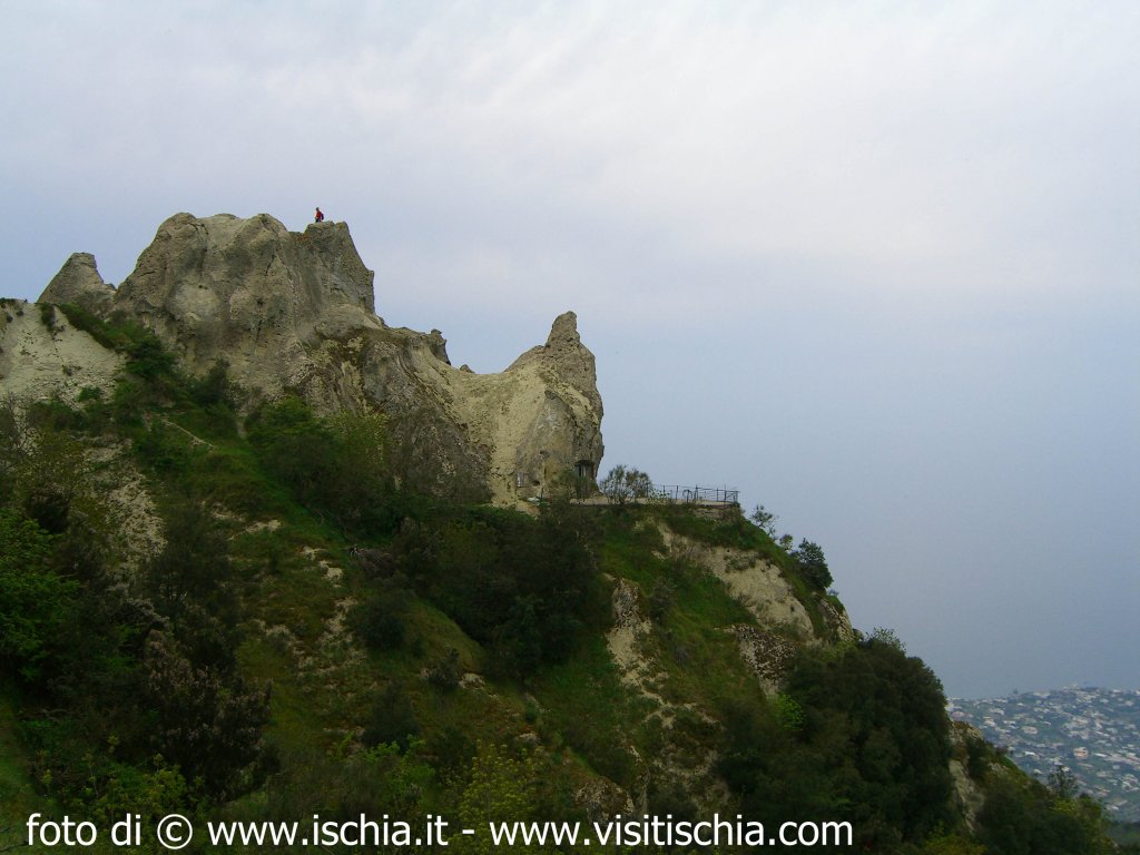
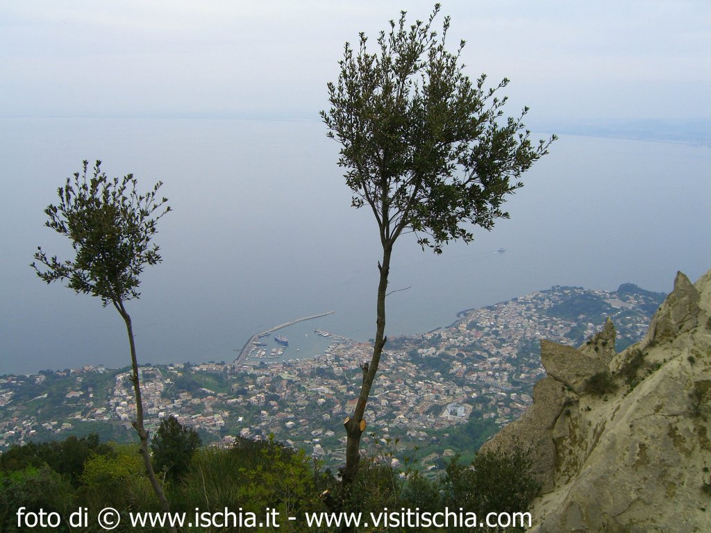
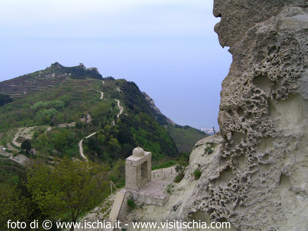
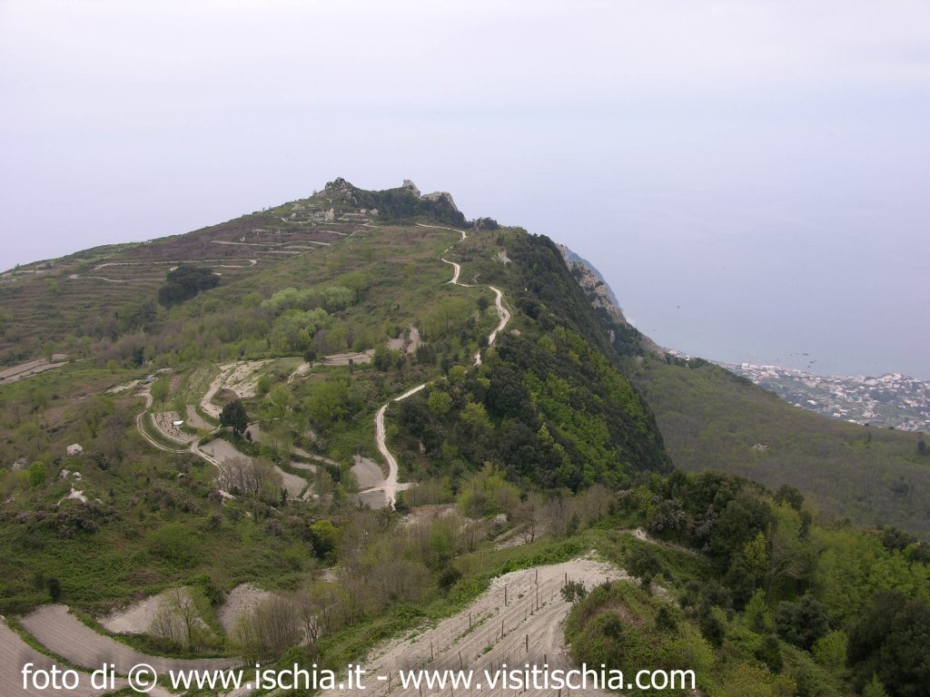
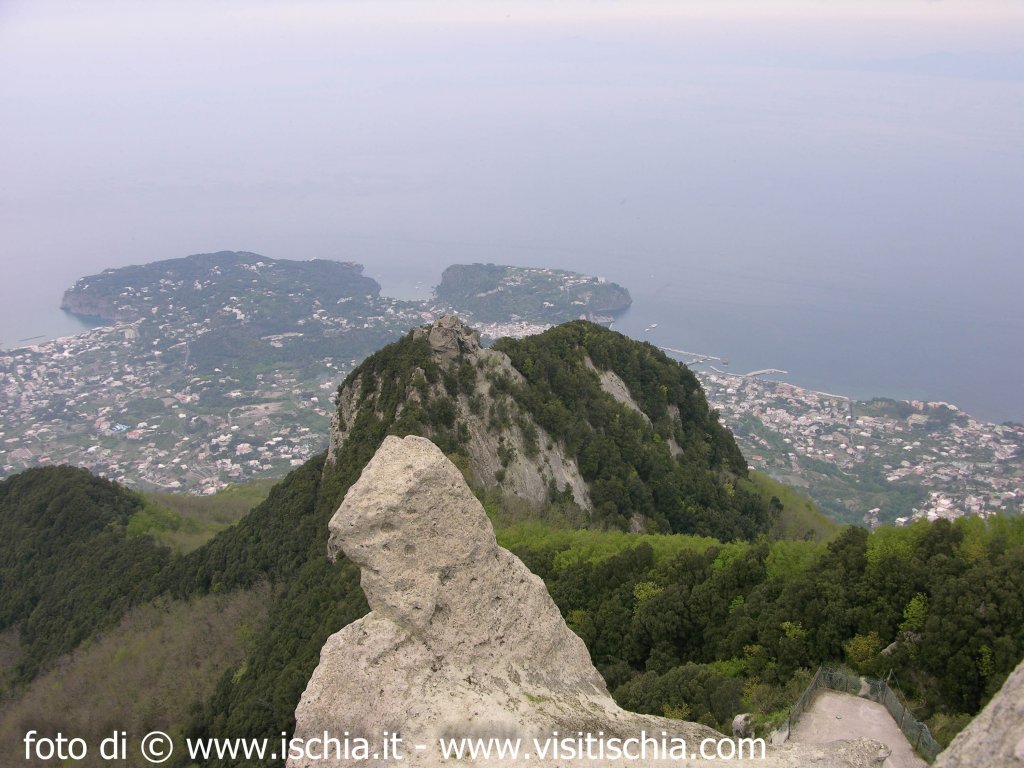
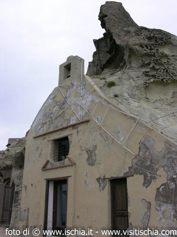
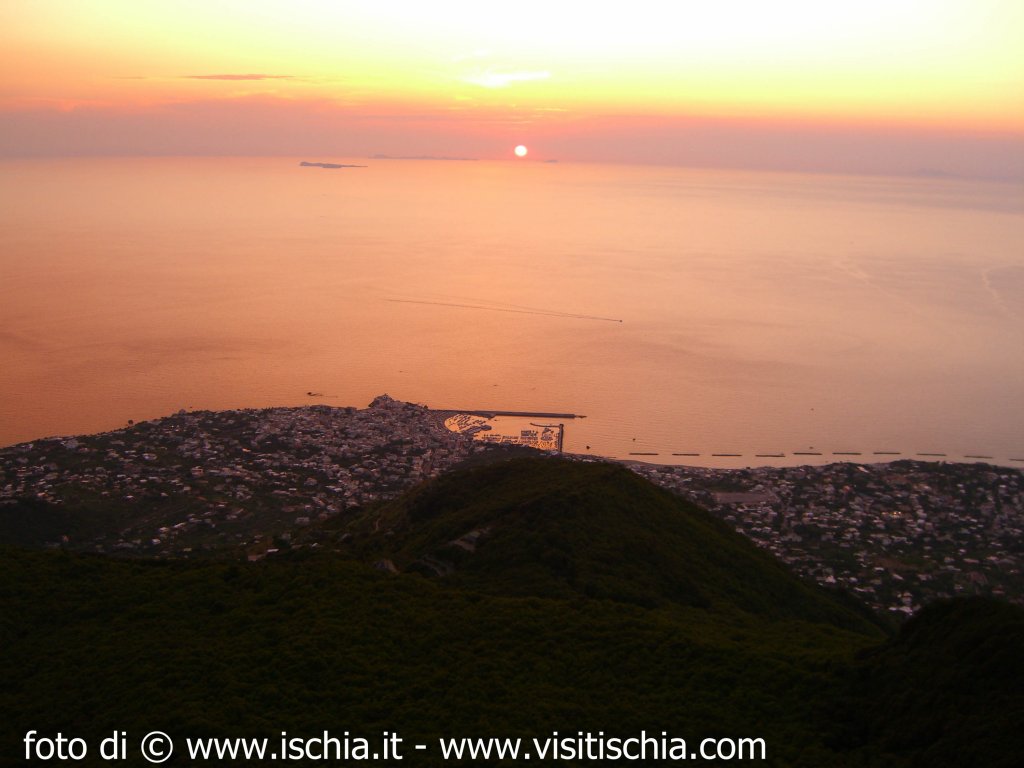
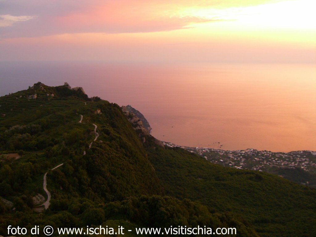
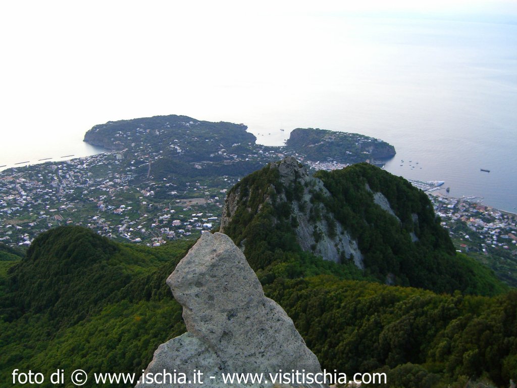
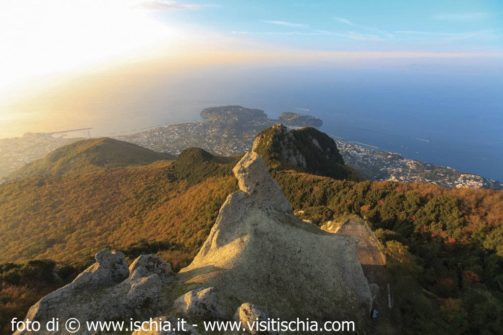
Leaving this 'salgarian' place, you reach a grove of chestnut trees on the slopes of Mount Trippodi (502 m), until you reach Piana St. Paolo, old fossil beach, evidence of the past submerged part of the island. In fact, as we said before, for thousands of years the central part of the island, following the collapse due to emptying of the magma chamber, result of very intense explosive activity, was found in a sub marine. It's definitely one of the most significant events of the geological evolution of Ischia, where it was created the typical rock of the island: the green tuff, formed as a result of the alteration - chemical physics of pyroclastic rocks, visible today, such as other submerged structures, following the resurgence of the mass collapsed. Continuing the ascent, it has come down to the highest point of horst (it is so technically called Mount Epomeo: horst - Volcano - tectonic). At the top (789 s.l.m.) is the church of S. Nicola (from which derives the name of the summit) with its hermitage carved into the stone green spaces, where for years has stayed the hermit Giuseppe D'Argout, former commander of the garrison of the Aragonese Castle in 1700. The hermitage was converted into a charming guest house where rooms are old and silent cells. Today, unfortunately, has been abandoned. A path carved into the stone leads to the summit, carved by wind and edged with yellow lichen. From here you can enjoy a 360 degrees (from which the origin of the name Epomeo: Epopon or Epopos I look, I aim around). In front of the wood is recognizable Falanga with Santa Maria al Monte, Monte Nuovo and Forio below. The Pontine islands, not so far away, form a continuous line with the Lazio coast. By shifting the gaze to the North Coast appear the Phlegrean islands of Procida and Vivara, Vesuvius, and pursuing Lattari mountains and the island of Capri. And then the view is lost at sea and has the feeling of being suspended between sky and sea.
On our left (south) another peak: is the Pietra dell'acqua, the next destination of our path. The gentle slope that leads them is shaded by oaks and lined with heather and gorse. Then comes the tank which gives its name to the top, a large rock of tufa, which has been quarried and grooved to collect rainwater.
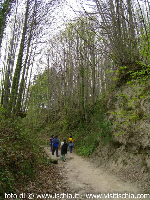
The path then becomes a dirt road going down from brambles and gorse (that are abundant in full bloom in spring) and come to a junction leading to the forest of Frassitelli, a magnificent vantage point of the western side of the island. It is not difficult to see the flight here proud and decided to some bird of prey (hawks, buzzards, kites). The locust trees in the forest shade to rocks covered with moss, lichens, and wild fennel. The underworld is the kingdom of the wild rabbit that has played and plays a key role in the local cuisine (especially because it is the recipe used to cook wild meat, which was and is flavored with its abundance of spices typical of the Mediterranean territory, we have met along the way). Continuing along the path, out of the woods, alone, to gain another.
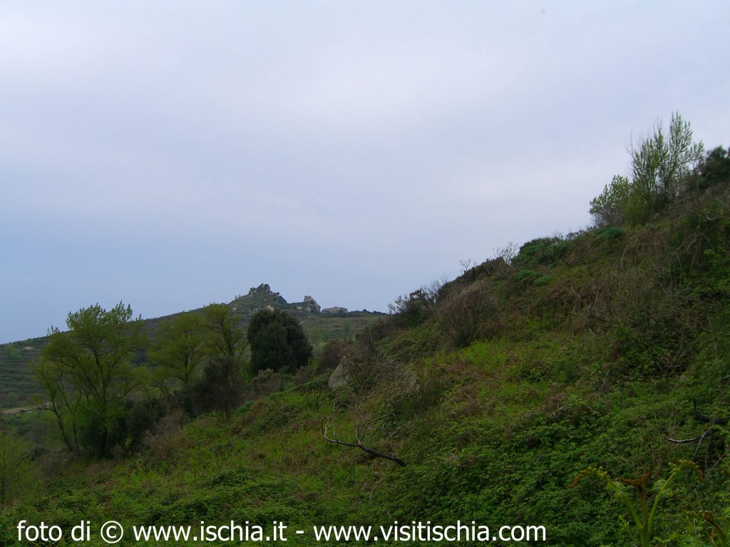
We are in one of the green lungs of the island, the forest of Falanga, also home of the ubiquitous green tuff, a union where reality blends with fantasy. The Falanga wood consists of a terrace about 600m above sea level, at the foot of Mount Epomeo. The latter is formed as a result of a rise in the earth's crust. It's evident, in fact, the fault surface, which is a majestic wall of green tuff, carved by wind and dappled with lichens, covered with oaks, wherever the slope allows. As they venture into the woods one has the sensation of entering another dimension. The huge blocks of tufa, in the course carved from the elements (eg the so-called stone "Perciata", the characteristic erosion in tafoni or honeycomb), partly dug by men who have made millstones, deposits and temporary shelters.
The houses of stone, rock testament to the island, are so perfectly integrated with the vegetation and the environment, to blend with nature and with nature for this to become an excellent defense against pirate raids. Here they form a real village, which together with the remains of ancient parracine (now covered by vegetation) show traces of a past in which the screws were to dominate the landscape and the chestnut trees. Therefore one can assume with sufficient certainty the development and the presence in the area of a widespread wine activity.
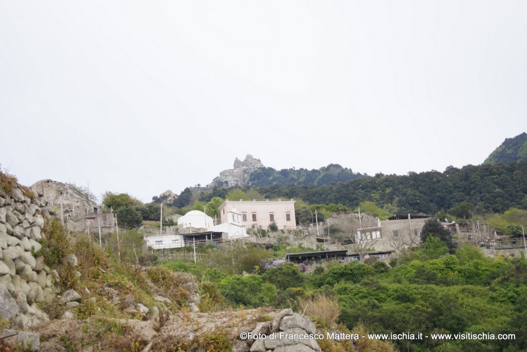
Of particular interest are the "pits of snow" that you meet along the way. These holes dug in the ground cylindrical and coated with local stone, which were used to collect the snow, especially in times past, was more abundant and necessary for different uses. After a moment of abandon and relaxation in this fairytale world, return to the path that leads toward the wall of the fault. Climbing again, wrapped in oak and heather, we reach the summit of Mount Epomeo. Turning to the left instead, you get into an old mule, surrounded by chestnut trees, which pops up in a small rural agglomeration built around a church dedicated to Our Lady: the village of Santa Maria al Monte, a focal point, connecting the various paths used for activities related to the production of wine. The space in front of the Church offers a wonderful panoramic view of the entire town of Forio. We are now to the western side of the island and we also realize that the landscape changes completely: The abundant and lush greenery that has accompanied us in the first section of the trail is only a memory. In this area, given the type morfoedapic, the springs and fumaroles strong exposure to the sun, the vegetation is very uncommon, but the spiny prickly India, along with the agave, the colorful plants and aloes Mesembryanthemum give a touch of exotic to the landscape.
At this point the trail becomes a road. Along the way are evident examples of the above blocks of tufa, in fact transformed into homes, cellars or warehouses and placed in a mainly agricultural, where the cultivation of the vine and wine production were (and in some ways they are yet) are well developed. The plots of land, which, given the topography of the area, develop vertically are terraced with dry stone walls made from local so-called "parracine". Hence, among occupied houses and countryside, you arrive to the Piellero where you come across an ancient source of drinking water (not the only island), on whose right stands a small chapel dedicated to Sant' Antonio. The tour continues with the arrival at the port of Forio. Forio, the largest municipality of the island, stretches between two promontories, Punta Caruso to the extreme north west side of the area and Punta Imperatore to the extreme West. At the port, is the so-called Torrione, a circular green stone, which seems to watch over the harvest of houses. The green tuff, which together with the dense and luxuriant vegetation, has earned the nickname of "green island", characterized by the same architectural layout of the entire country and is visible to the careful eye of a knowledgeable observer. The green rock is the testimony of the geological history of this territory. In fact, in the past, as a result of tectonic subsidence, large masses of green tuff are rolled down the hill and have become architectural elements seamlessly integrated with the territory. But this requires a separate itinerary.
And so that the correct conclusion of our journey. And, after traveling through various environments and in history, embodied within the life force of this island, a force that surrounds and nourishes us too, travelers in search of an identity, a unique experience that allows the body to rebalance itself with the spirit.
Info on the trail hiking
- Maximum height: 789 m
- Vertical drop: 400 meters uphill, 700 meters downhill
- Duration: about 8 hours
- Development of trail: 12 Km
- Difficulty: E
- Equipment autumn / winter: boots, jacket, ultiple layers of clothing, water
- Features spring / summer: hiking shoes, long pants, shirt dry parts, water
- Departure: Fiaiano (reachable by bus No. 6 from Ischia Porto)
- Arrival: Forio
- Path: Fiaiano, Monte Toppo, Buceto, Piano S.Paolo, Monte Epomeo (top of St Nicola), Pietra dell’acqua, Frassitelli wood, Falanga wood, Santa Maria al Monte, Forio.
by Francesco Mattera
Director of the CAI section of Naples, Coordinator for the Island of Ischia and GAE (Environmental Guide)
For information on activities and excursions: 3297448752; This email address is being protected from spambots. You need JavaScript enabled to view it.