")

The sound of the stones


The island of Ischia, thanks to its geo-morphological and climatic peculiarities, is a unique environment, boasting a rich and distinguished natural heritage by its geographical and biodiversity. The most common name that is given to this oasis in the middle of the Mediterranean Sea is "green island".
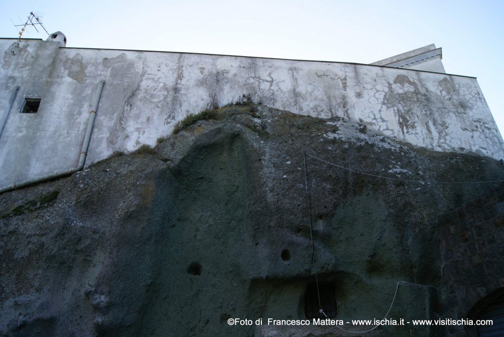
It is immediate reference to the dense and lush vegetation, especially on the north east, extending lush. But, of course, the element which distinguishes it most is the typical rock island, the “green tuff”, which characterizes the architectural layout of some areas of the island, in particular of Forio and is visible to the careful eye of a knowledgeable observer. The green rock is the testimony of the geological history of this area. In fact, in the past, as a result of tectonic subsidence, large boulders of green tuff is rolled down the hill Epomeo and have become architectural elements perfectly integrated with the territory.
The close relationship between natural, geological, historical and cultural features makes the journey of discovery of the island a way to observe and experience the region highlighting the strong local identities tightly integrated with the natural environment.
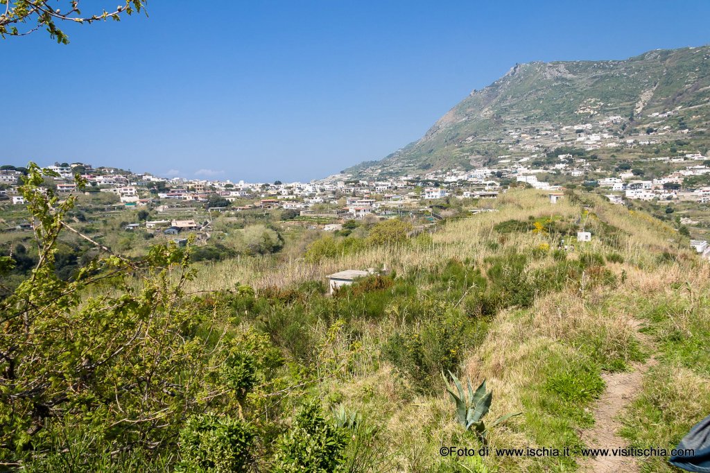
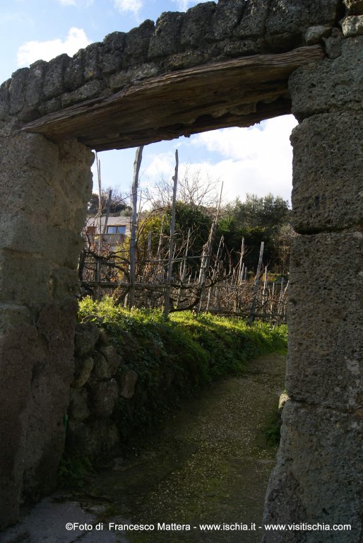
The route proposed here is just an example of how the interplay between history and architecture (ancient human intervention to date), be in harmony with the environment, but is meant to be a contribution so there is a greater awareness with respect to the care of this territory, its protection and enhancement. From the parking lot of the restaurant "Cenerentola" at the external borders of the village of Panza (municipality of Forio), we proceed for about 100 meters, on the main road until Via Pietra, lined with ancient houses and cellars peasant, introduced by an enormous mass of green tuff, which reminds us of the turbulent past of the island and the majesty of the events that occurred here. It is particular the way in which a natural element is here transformed by human intervention: the rock was excavated so as to create, in its bed, nine rooms used as cellars, with its tanks to collect water. In the logic of peasant re-use of any natural product, the material removed during the excavation was used to build the houses above the mass of green tufa. The intervention is also clear in the dry stone walls (the so-called "parracine") which, built with the same local stone, mark the path. Here, too, the natural element that accompanies that human one: between the cracks and on the stones of parracine and along the road slightly uphill grow various wild plants (ivy, parietarie, hunting hares, capers, etc..) And you can see behind the stone walls, the fields planted with vines and fruit trees.
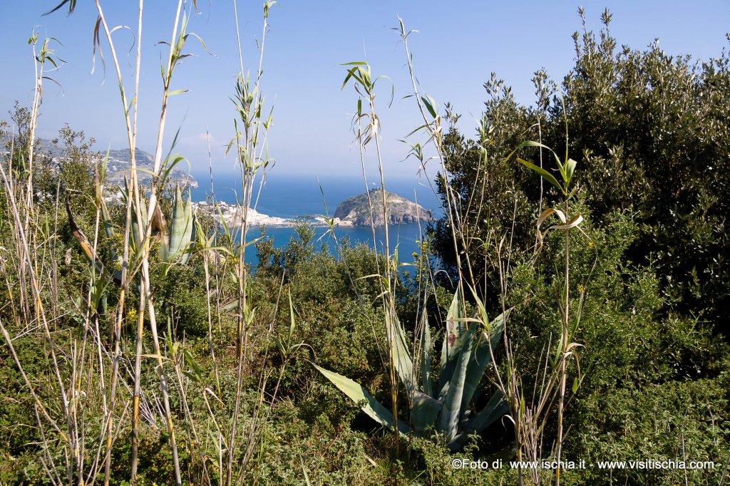
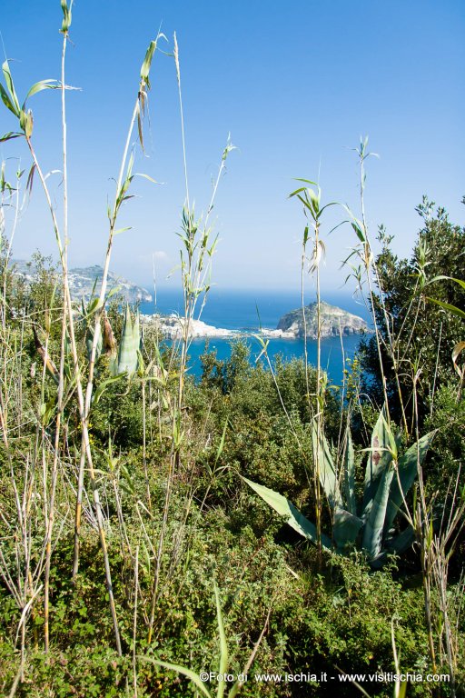
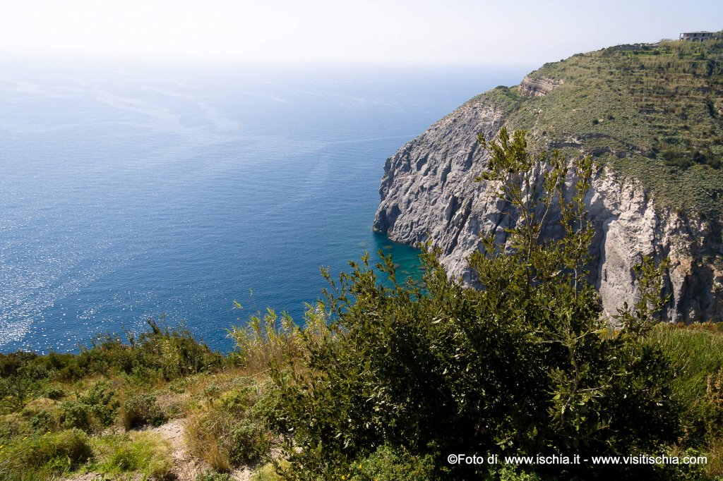
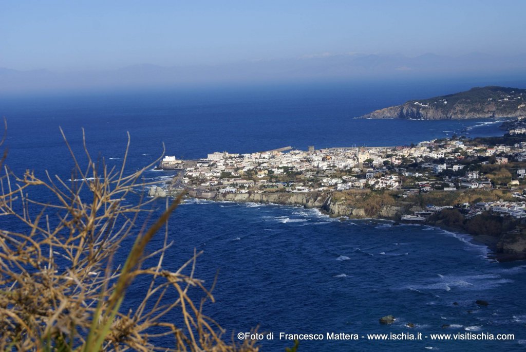
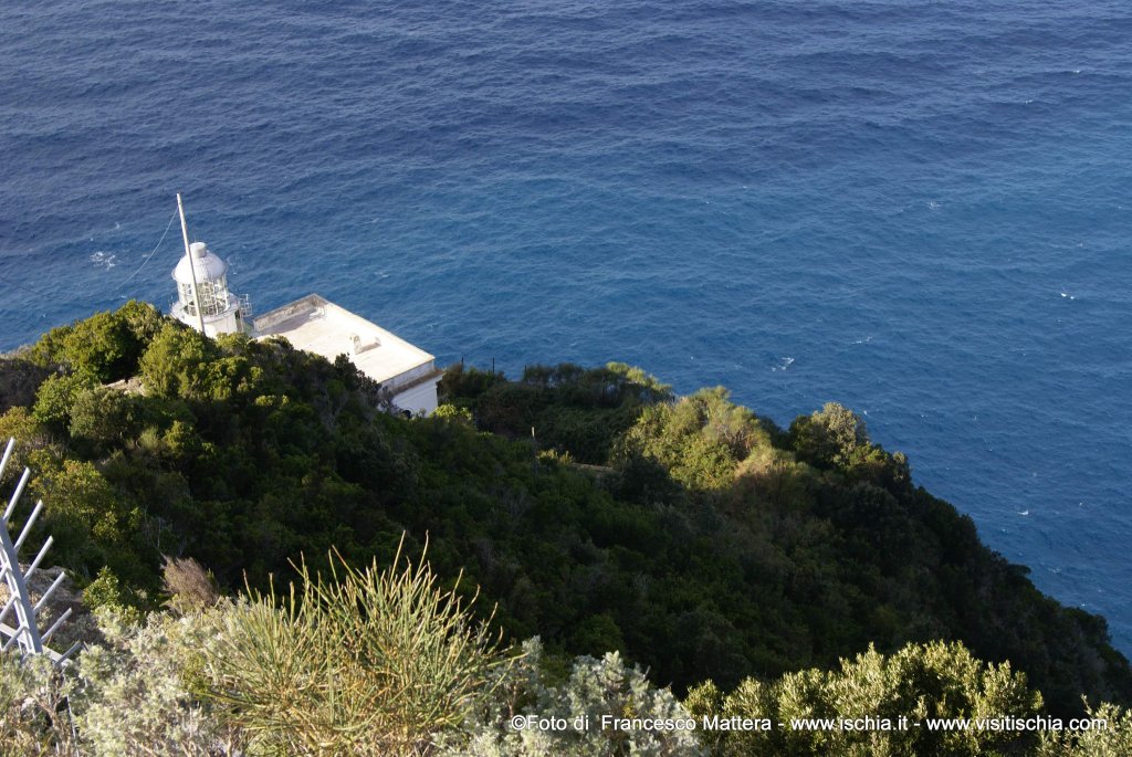
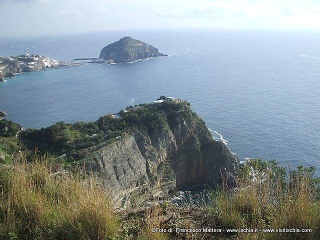
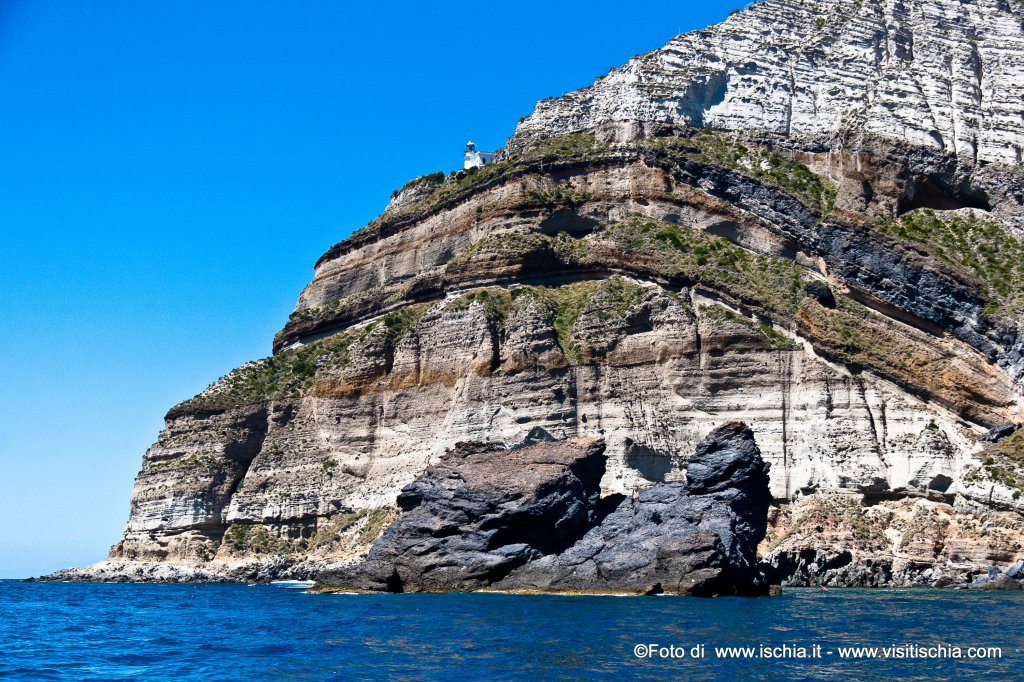
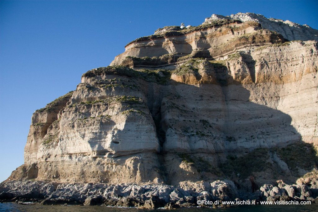
Arrived at Via Costa, continue uphill to a crossroads, marked by the presence of the bar "Faro". At the top, the view opens on the promontory of Punta Imperatore, with powerful volcanic rock formations, whose main characteristic of man is the lighthouse, whose beam of light still comes to the Circeo.
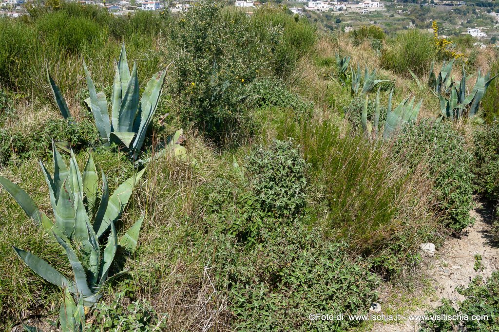
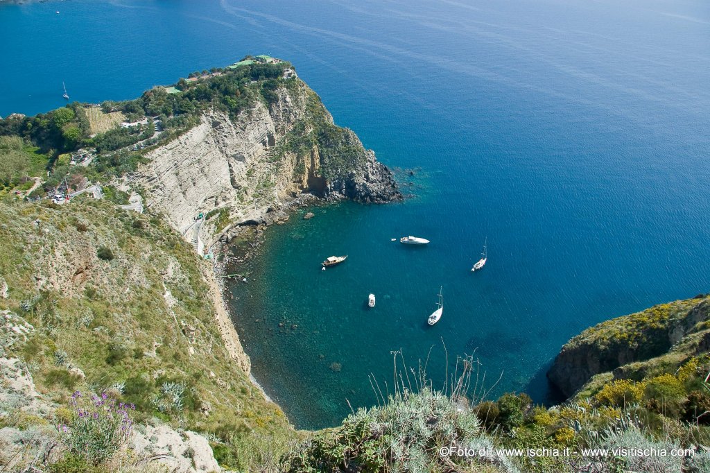
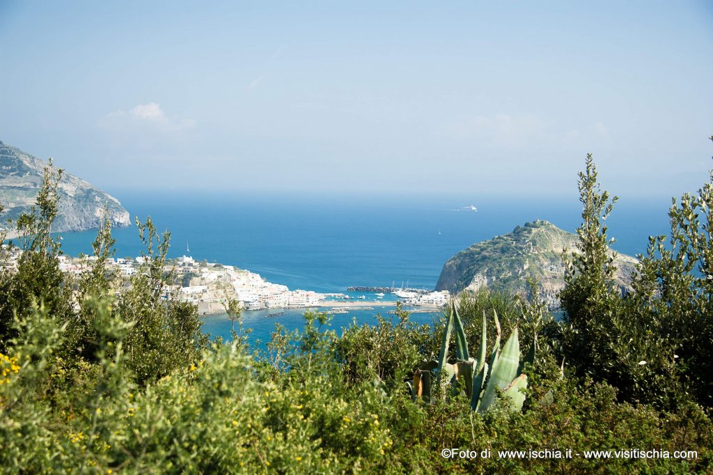
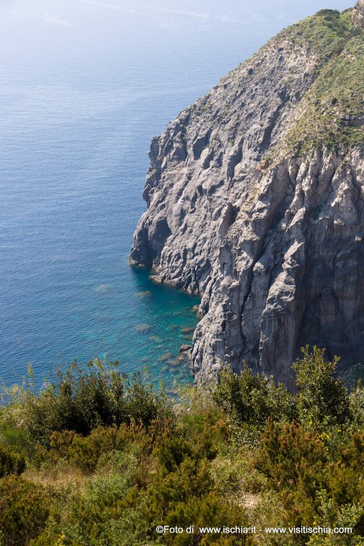
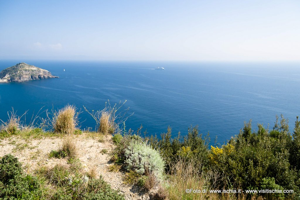
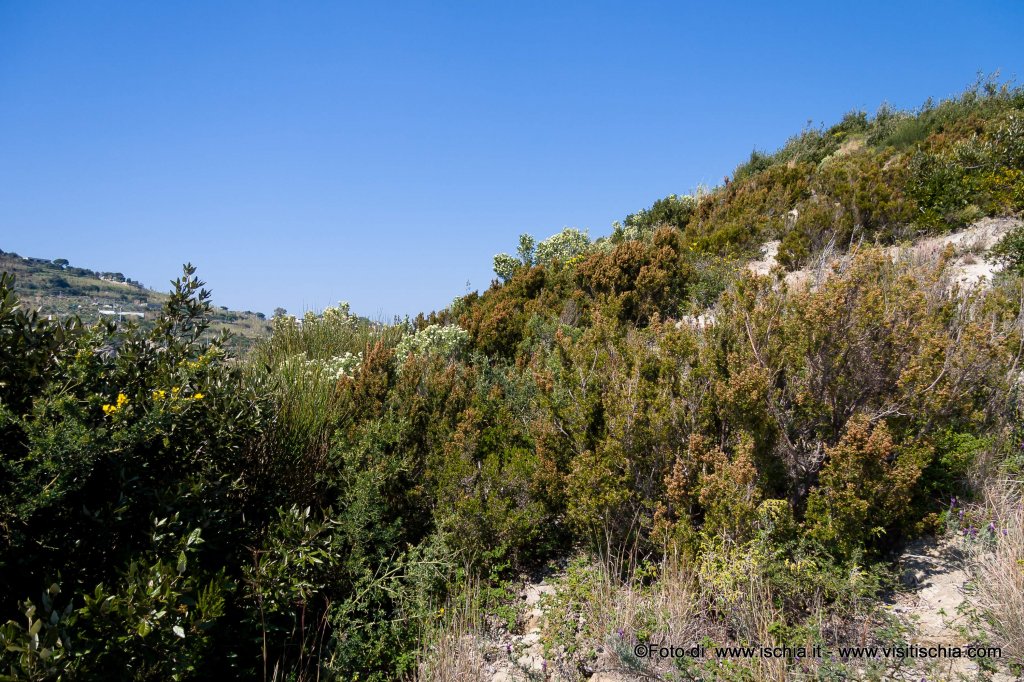
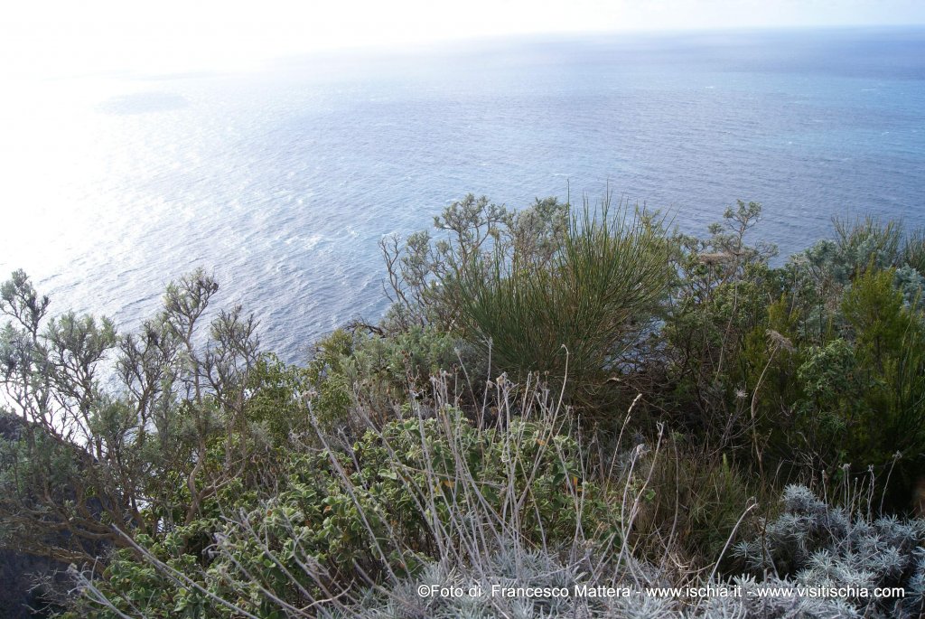
In front of the open sea, where, in clear days, you can recognize the Pontine islands and in particular Ventotene and Santo Stefano, the cliffs rise characterized by the presence of different volcanic materials laminated. The feeling here is to read a history book that tells us about the various stages of the genesis of the place, as old as the island itself. The promontory of Punta Imperatore is the result of several volcanic events: on the base surfaced clinkers of grey trachytic lava in composition, overlapping to layers deposited from volcanic ash and pyroclastic eruptions later. On this substrate grows lush coastal vegetation typical of the Mediterranean Sea: rosemary, cistus, the beard of Jupiter, the everlasting, the agaves, prickly pears and the timelea. The free horizon allows the eye to reach up to the full view of Forio, including the promontory of Punta Caruso and beyond, towards Monte Vico, in the municipality of Lacco Ameno, the site of the first settlement of the Greek acropolis on the island, which is also the first in the West.
Beyond this moment of "sublime slip" in time and space, the path continues, returning to the previous intersection. Turning right once and, shortly after, turning right, along the Scarrupo of Panza, whose center is located at the tip of eruption ship and consists of pyroclastics of benches waste trachytic welded overlapping schools of pyroclastic breccias of fall. You then go in the direction of the area known as the Pomicione, trachytic fall deposit of lava from a light color, then covered by pyroclastic of Punta Imperatore (clearly visible along the way).
The path now leads gently, at the junction leading to the center of Panza.
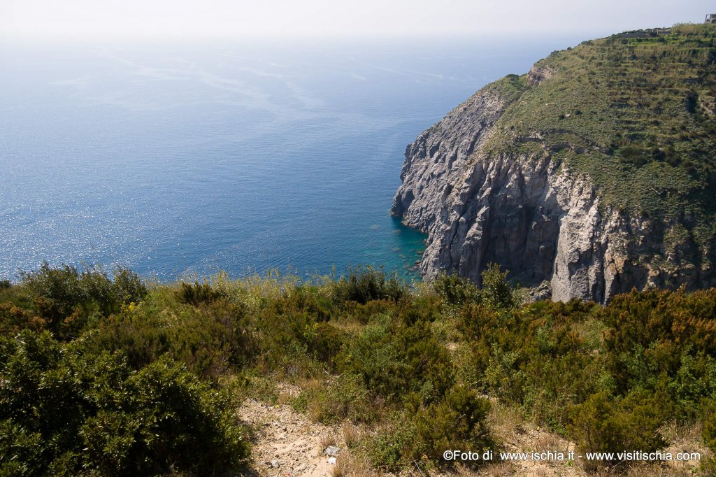
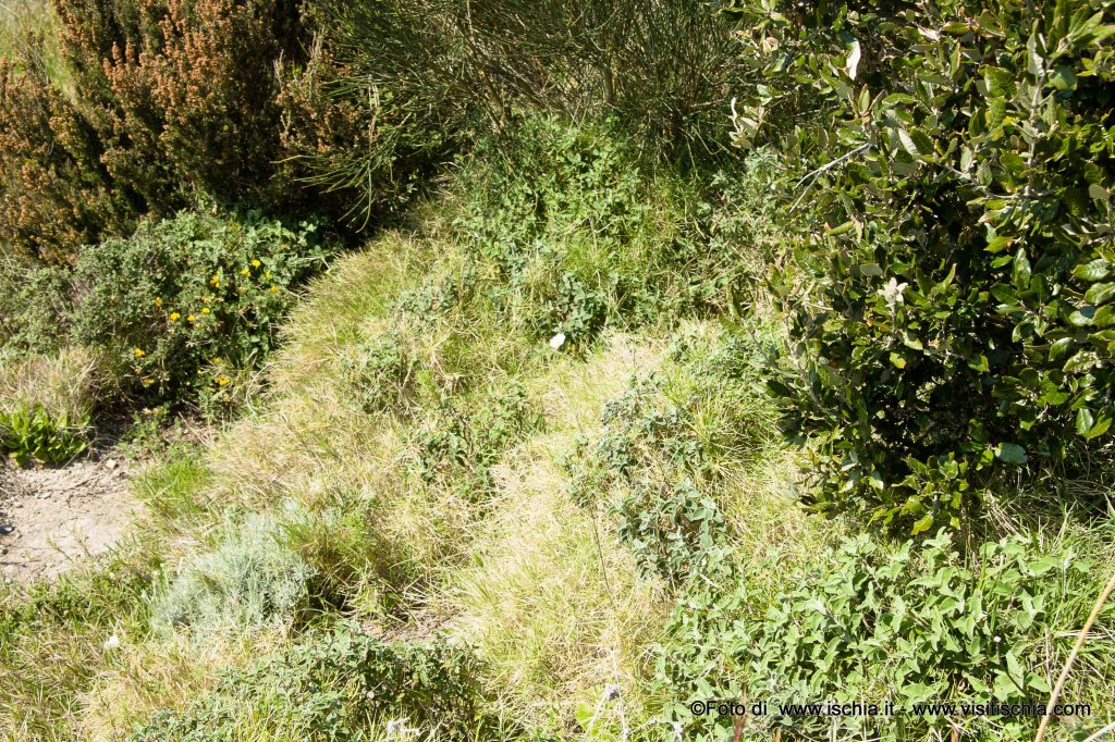
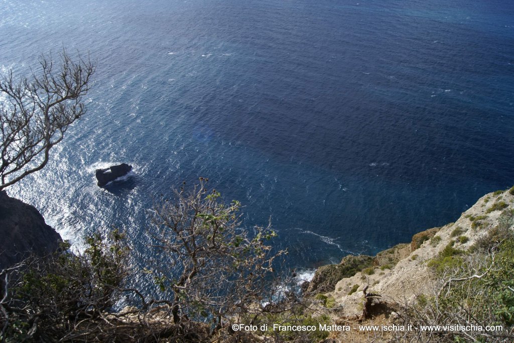
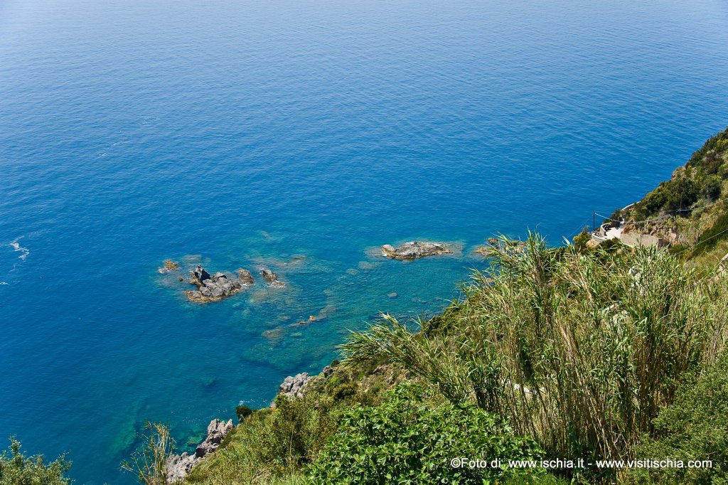
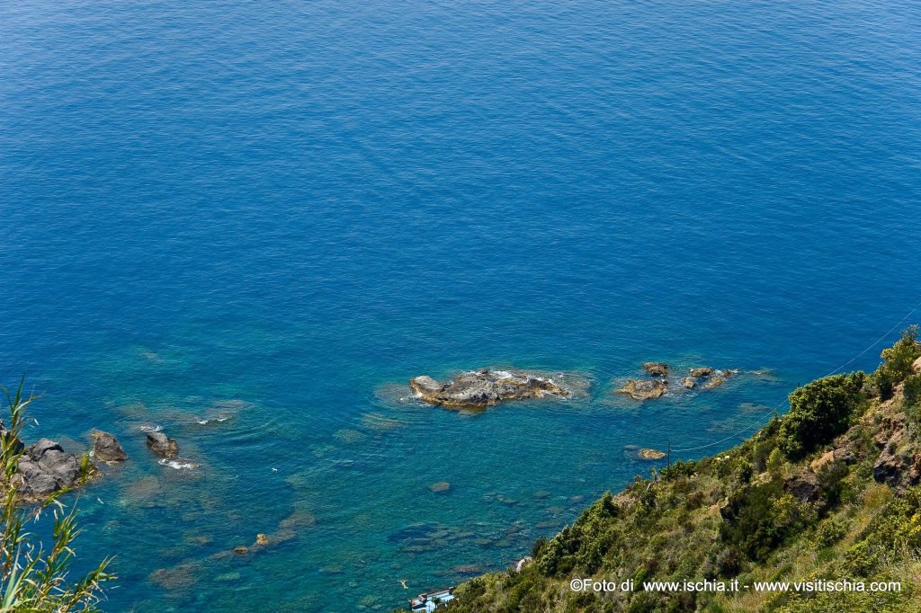
Turning right towards Sorgeto and follow the driveway until you come to a small fork: to the right, you walk a few meters along a row of houses surrounded by green and you come across the junction from which are two paths. The first one, with a moderate altitude (about 100 m), forwards in a valley of orchard and continues until the Pelara bay. The descent is introduced by a steep staircase with wooden steps carved into the tufa wall leading to a layered pumice, ash and lapilli. From here, the trail winds through a lush grove of oak trees, but we also find species typical of the Mediterranean maquis: heather, arbutus and mastic. In the wood, also hides the "hermit’s cave", carved into the tufa rock. Beyond this, you will come across a beautiful glade of ferns, especially in the spring is easy to pick wild asparagus. Beyond the clearing, a rustic staircase, built by volunteers from the Pro Loco of Panza, allows to overcome the difference in an easy way, to get to the coast and the sea. The descent is wonderful, because gives the opportunity to observe the multicolored cliffs, ranging from grey to black to red (trachytic rocks blackish alternate pyroclastic reddish). The different colors indicate the presence of different minerals lava. It is, in fact, a remarkable geological site, which culminates in a massive grey lava rock, about 80 meters high, stands on the sea, creating the play of light and color of a certain rarity.
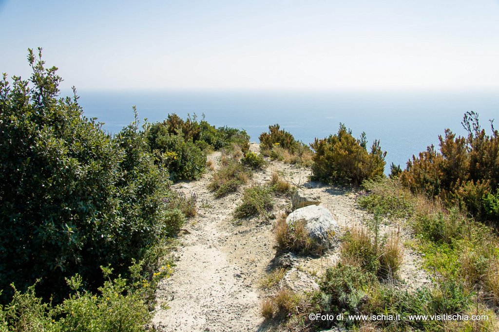
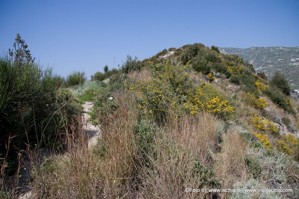
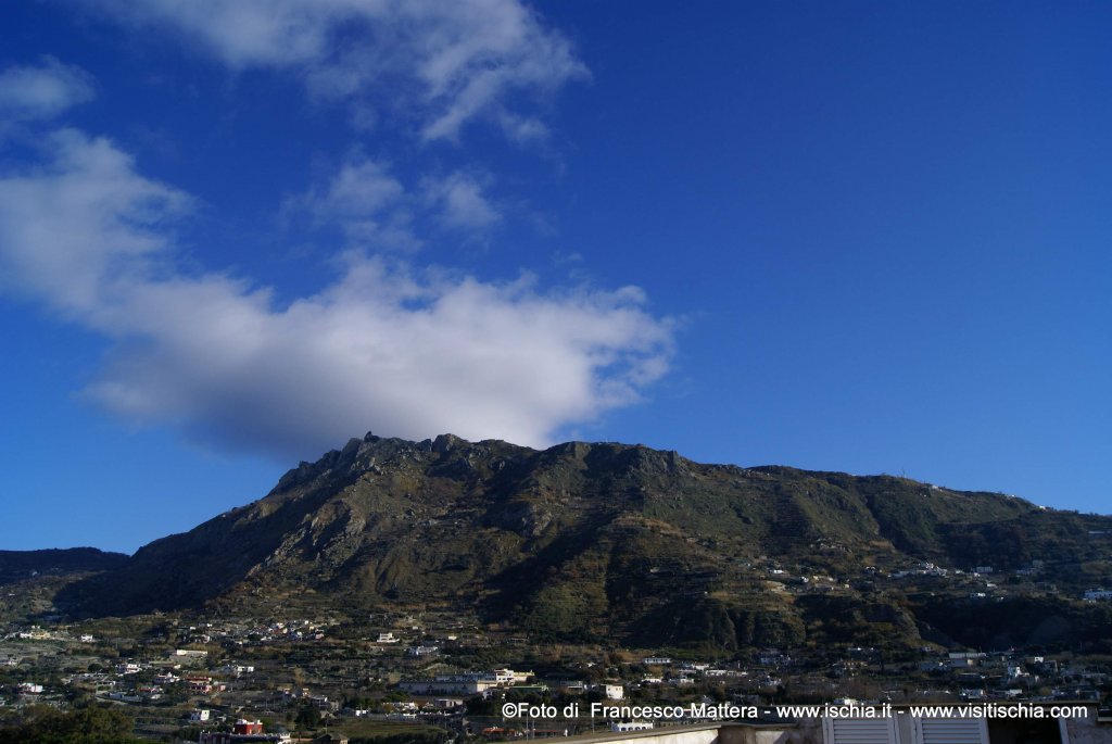
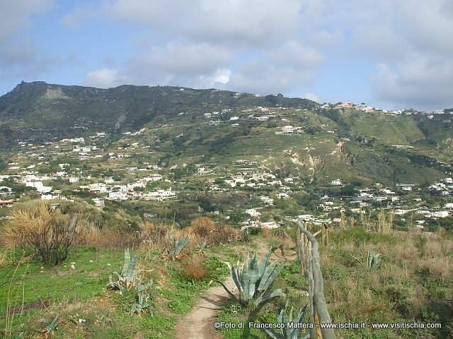
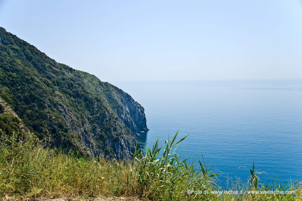
To reach the second path, it comes back and head towards the Mount of Panza, among vineyards and scrubland areas, whose predominant color is the yellow of the brooms in flower from June onwards. In addition to the typical coastal vegetation is the presence of special natural interest Orchid Serapis. Through a broad, flat ridge, the look is completely free to expand offshore, with a view on a clear day, the Punta Campanella and Capri eastward and westward Ventotene. A viewpoint that invites to meditation aimed at rebalancing psycho - tax, together with some bench, closes the highest part of the mountain and plain: from here you can admire the island, the area between Santa Maria al Monte, passing to Bocca di Serra, until Serrara, Vezzi Monte, Monte Cotto, the bay of Ischia, Sant’Angelo and, finally, Sorgeto.
A visit to this area will be complete only with the descent to the bay of Sorgeto. The driveway to go down in the bay, take from the same crossroads that led to the two paths described above. So, back there, turn right and proceed comfortably up to an open space in front of the restaurant "Da Gisella". From this point, depart the 300 steps that lead to the hot thermal water pools that characterize and give the name to the bay. During 1500, the Calabrian doctor G. Jasolino, who first examined all the thermo-mineral waters that come to the island to study the various medicinal effects, judged the current hot Sorgeto "beneficial to gout, to frigidity and sterility". Embedded between two headlands, pebble, not too wide, the valley is full of hot water up to 90°, and then mix in the cold sea, creating, even in winter, the possibility of retiring with pleasure and benefit.
At this point, after having satisfied the body and spirit, you will return back to the starting point, reminding the narrator of the stones on the way there. Sure, why the stones, to know how to listen and watch, both in its natural state, is fabricated, retain and talk about the stories of the places and of those who experienced them. And to not to lose these stories that you need to give more attention and love to these places that give us so many free and wonderful emotions, but in some places are really abandoned. The protection and enhancement is a social duty that we owe to this land and, therefore, requires a more involved feast for everyone, from those who administer the territory.
by Francesco Mattera